Fastest
1 hr 11 min15.2 mi wetWeather-aware navigation for riders
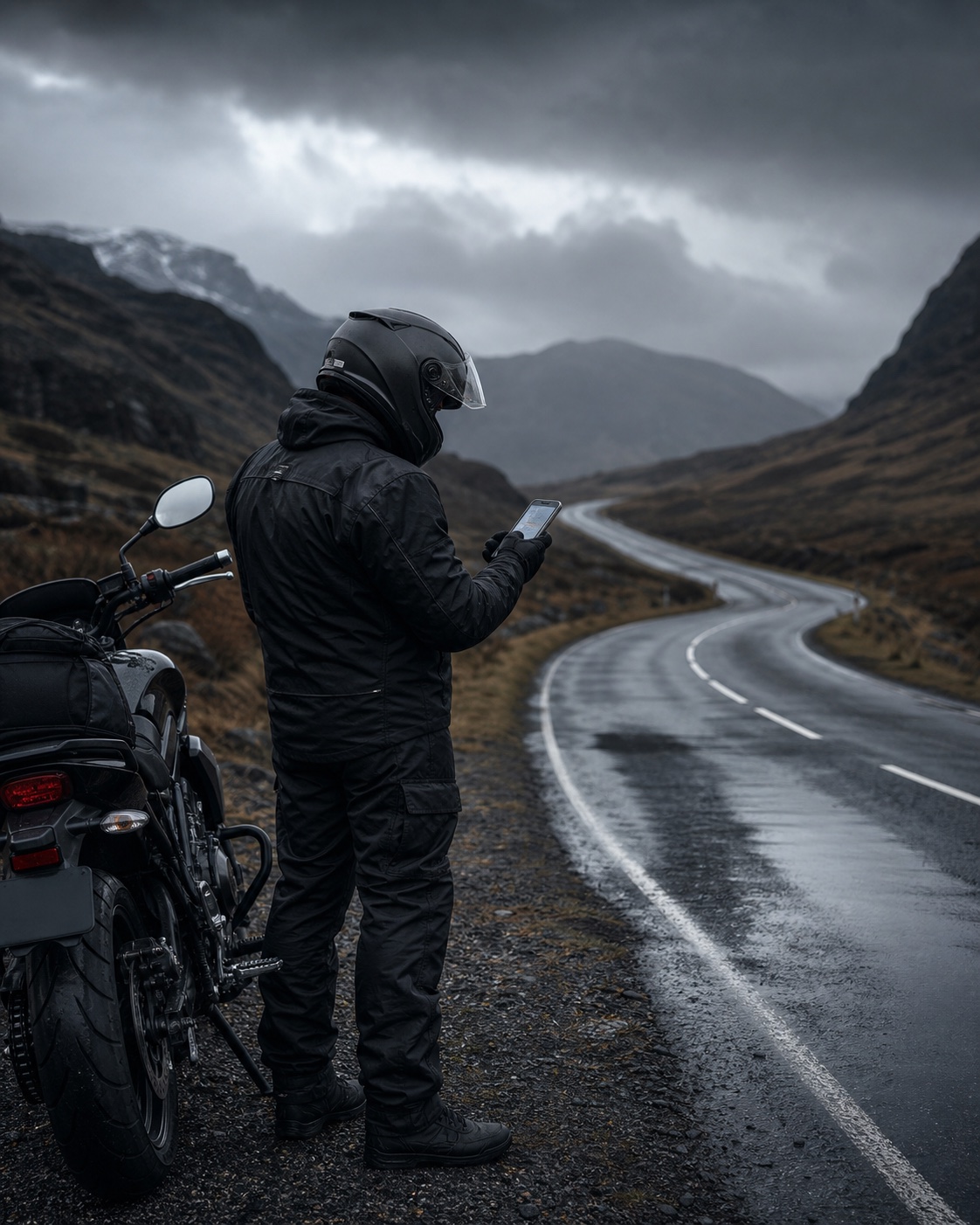
Ride the
driest line.
Weather-aware routes for riders who would rather miss the rain.
Apple MapKit routesWeatherKit forecastsNo account required
01 · The trade-off
Fastest isn’t driest.
DryRide does the maths on every option so a few extra minutes can mean a lot fewer miles in the wet.
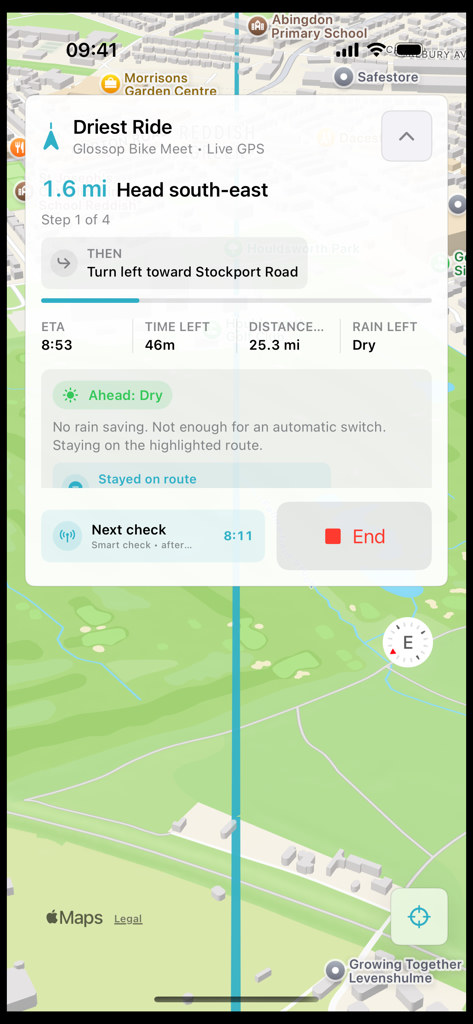
Driest Ride
1 hr 24 min6.4 mi wet8.8fewer wet miles
02 · Route intelligence
Know the rain before it finds you.
Every route is sampled against WeatherKit, so the dry trade-off is clear before you leave.
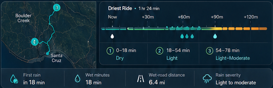
- Rain severity
- Light to moderate
- Wet-road distance
- 6.4 mi
- First rain
- in 18 min
03 · The app
Plan. Compare.
Ride drier.
Real screens from real rides. No concept UI, no hidden complexity.
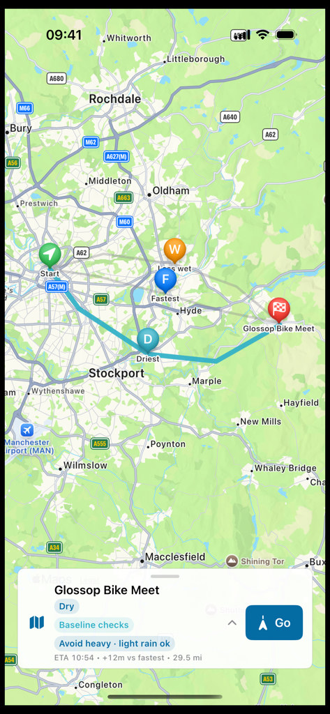
Compare routes
See the dry trade-off before choosing a line.
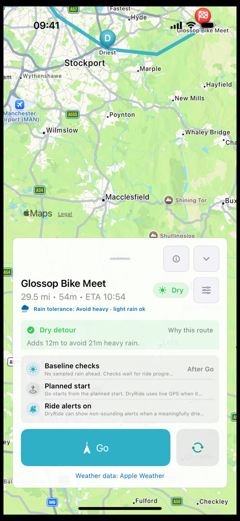
Plan the ride
Review rain exposure, timing and the reason for the route.
Ride drier
Keep the least-wet practical route as the forecast moves.
04 · Your ride, your call
How wet is
too wet?
Choose the trade-off that fits this ride. DryRide keeps the route practical as the forecast changes.
Prioritise dry roads for as long as a practical route exists.
- Time
- 1 hr 37 min
- Distance
- 72 mi
- Exposure
- 4.2 mi wet
Allow a light shower when it saves meaningful time, while steering clear of heavier weather.
- Time
- 1 hr 24 min
- Distance
- 68 mi
- Exposure
- 6.4 mi wet
Accept more light rain when the quicker arrival matters most.
- Time
- 1 hr 11 min
- Distance
- 62 mi
- Exposure
- 15.2 mi wet
05 · Respectful by default
Built for the ride.
Not the data.
- 01No account
- Open it and ride.
- 02No tracking
- Your route is not used to follow you across apps.
- 03No advertising
- No ads. No sale of rider data.
- 04Apple MapKit + WeatherKit
- Routing and forecasts from Apple services.
06 · Questions
Before you download.
When can I download DryRide?
The iPhone app is built and being prepared for App Store release. The download link will appear here as soon as it is live.
Is it only for iPhone?
Yes. The first version is made for iPhone and uses Apple MapKit and WeatherKit for route and forecast data.
Does DryRide reroute while I’m riding?
Yes. DryRide checks rain from your live position and can alert you when a meaningfully drier route opens up. Pull over safely before interacting with the app.
Does it replace checking the weather?
No. DryRide is a planning and guidance aid. Forecasts change, so always review the route and ride to the conditions you encounter.
Do I need an account?
No. DryRide is a focused utility with no account, no advertising and no cross-app tracking.
Soon on iPhone